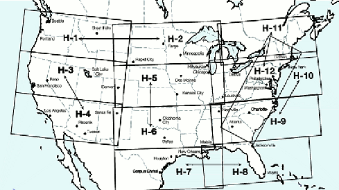
Enroute High Altitude
IFR Enroute High Altitude Charts (Conterminous U.S. and Alaska) are designed for navigation at or above 18,000 feet MSL.
Please enter quantity and click Add to Order.
Web Hosting powered by Network Solutions®